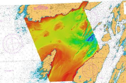
Contracted by NetSurvey to provide a Reports Coordinator for the MCA Inner Approaches to the Firth of Lorne Survey. Conducted as part of the Civil Hydrography Programme, the 974 square kilometre survey area is on the west coast of Scotland, bounded by the Isle of Mull to the north, and Jura to the south, extending from Colonsay in the west to the Garvellachs in the east. The seabed topography is extremely varied. Large areas of fine sediments are interspersed with rocky outcrops and bedforms. Steep sided outcrops of bedrock occur around the Garvellachs, which extend north-eastwards beyond the survey area, along the Great Glen Fault. Three vessels have been utilised on the project – MV Triad, MV Seabeam, and MV Icebeam. Caris HIPS and Fledermaus were utilised to verify the data, with a Report of Survey submitted to the UK Hydrographic Office, along with high-resolution FM Geocoder backscatter data and seabed samples to support seabed classification.