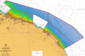
Contracted by MMT AB to provide a Reports Coordinator for the MCA Whitby to Redcar Survey. Conducted as part of the ongoing Civil Hydrography Programme, the 603 square kilometre survey area is on the north east coast of England, extending from Redcar in the north to Robin Hood’s Bay in the south. The seabed topography is remarkably spectacular, with complex geological bedrock features across the site, and sandwave areas nearshore in the south. Two vessels were utilised during the project, with MV Icebeam surveying the deeper areas, and MV Seabeam concentrating on the shallows. The data was verified using Caris HIPS, with a Report of Survey submitted to the UK Hydrographic Office along with the processed data to enable Admiralty Chart revisions. High-resolution FM Geocoder backscatter data and seabed samples to support seabed classification have also been submitted.